Zoning Search

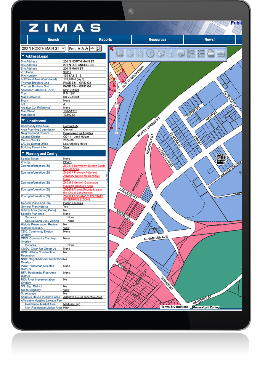
The Zone Information and Map Access System (ZIMAS) is a web-based mapping tool that provides zoning information for properties located in Los Angeles. ZIMAS was developed by City Planning to assist residents and businesses in making better informed land use decisions. The online mapping system is used to look up property information, ranging from a parcel’s land use and zoning designations to its planning application and building permit history.

The ZIMAS application is designed to provide zoning related information for specific properties. You can search ZIMAS by: Property Address, Street Intersection, Assessor Parcel Number, Case Number, Community Plan Area, Council District, Certified Neighborhood Council, PIN Number, Legal Description, and MapSheet.
ZIMAS Tutorial Videos
 
ZIMAS Brochure


If you’re new to ZIMAS or unfamiliar with the platform, the ZIMAS tutorial videos provide guided walkthroughs of the program. The videos demonstrate useful functions such as, searching for a property, finding zoning information, changing map backgrounds, navigating to active project cases and more. Click the link below to access the tutorial videos.
 
The ZIMAS brochure is a printable guide that outlines where key property information on ZIMAS may be found. The brochure is available in both English and Spanish.
ZIMAS Tutorial Videos
 
If you’re new to ZIMAS or unfamiliar with the platform, the ZIMAS tutorial videos provide guided walkthroughs of the program. The videos demonstrate useful functions such as, searching for a property, finding zoning information, changing map backgrounds, navigating to active project cases and more. Click the link below to access the tutorial videos.
 
ZIMAS Brochure
 
The ZIMAS brochure is a printable guide that outlines where key property information on ZIMAS may be found. The brochure is available in both English and Spanish.

Helpful Tips

Find the Zoning for a Property

Zoning rules inform what can be built on a property and how land is allocated at the local level. In ZIMAS, users can easily locate the zoning under the “Planning and Zoning Menu.”

Verify Limitations

Most properties across Los Angeles are subject to some type of overlay, an additional layer of planning control that limits or further restricts what can be built beyond what the zoning allows. Within ZIMAS, information is listed as to whether a site is located within a Historic Overlay Preservation Zone, a Specific Plan, or even a Community Design Overlay to name a few common examples. Click on each set of corresponding links to obtain additional information.

Read Up on the Local Regulations

Chapter 1 of the Los Angeles Municipal Code (LAMC), referred to as the Existing Original Zoning Code, went into effect on June 1, 1946 and applies to all areas of the city except the Downtown Community Plan. The Original Zoning Code can be accessed here.

Chapter 1A of the LAMC, referred to as the New Zoning Code, went into effect on January 31, 2025 and applies to the Downtown Community Plan Area and all subsequent Community Plan Area updates. The effective version of this Zoning Code Can be accessed here. For a more interactive and customized experience it can also be accessed via our Interactive Web-Based Zoning Code.

Contact the Public Counters

It could be challenging at times to navigate across a number of planning documents. For any questions, contact any of the public counters where planning staff is located. The public counters serve as a single portal and point of consultation for project applications.

zoning search
ZIMAS User Guide
 
By using the latest technology, ZIMAS is able to link together various digital maps and databases. In doing so, it allows its user to display layers of information in a manner that is both easy to visualize and understand. A series of helpful documents and tutorial videos have been developed by City Planning to assist in accessing this application.